







 Contact Platform Support
 Help Center
Passive Source Seismic Sensor Borehole Seismic Sensor Node Seismic Sensor for Dam Monitoring




Related Products
-
 ARM FPGA Data Acquisition System Remote Reference MT Station IP Resistivity Imaging EquipmentNegotiableMOQ: 1 Set
 -
4-20mA Water Level Transmitter Sewage Level Sensor Liquid Level SwitchNegotiableMOQ: 1 Piece
-
SP Measurement System VES Resistivity Survey KitNegotiableMOQ: 1 Set
-
Seismic Impact System Geotechnical Seismic Source Surface Wave Seismic SourceUS$ 500MOQ: 1 Set
-
Geomagnetic Field Instrument High Speed Magnetometer Magnetic Field SensorNegotiableMOQ: 1 Set
Shaping Sustainable, Resilient Cities Through Subsurface Intelligence
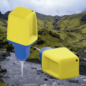
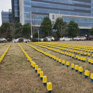
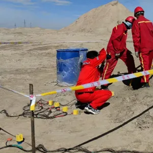
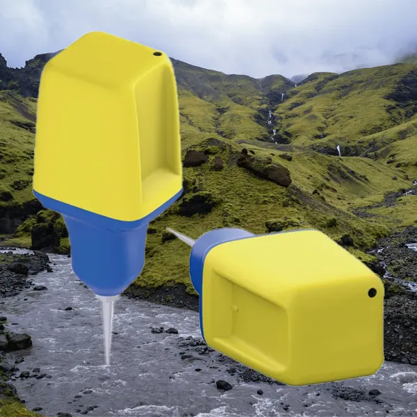
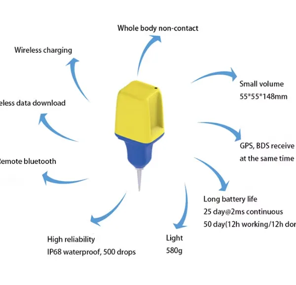
The cities of tomorrow must be built on a foundation of comprehensive geotechnical understanding. The GD-3C Nodal Seismometer serves as the Urban Planning Oracle, providing city planners, developers, and policymakers with the high-resolution subsurface data needed to make informed decisions about land use, zoning, and infrastructure development that will shape communities for generations.
Informed Land Use Planning and Zoning Decisions
Urban expansion often proceeds with inadequate understanding of subsurface conditions, leading to costly problems—from foundation failures to liquefaction damage during earthquakes. The GD-3C enables cities to conduct comprehensive geotechnical surveys across entire metropolitan areas, creating detailed maps of soil types, bedrock depth, groundwater conditions, and seismic site response. This information directly informs zoning regulations, guiding development toward areas with favorable ground conditions and away from zones prone to liquefaction, landslide, or excessive shaking amplification. The result is more resilient communities and reduced long-term costs from geotechnical failures and disaster recovery.
Optimizing Underground Space Utilization
As cities grow denser, the subsurface becomes an increasingly valuable resource for transportation, utilities, and commercial space. The GD-3C provides the detailed geotechnical characterization needed for optimal planning of tunnels, underground parking, and utility corridors. Its ability to image heterogeneities in soil and rock—from boulders to fault zones—allows engineers to avoid problem areas and align underground structures with favorable ground conditions, dramatically reducing construction costs and schedule risks. For existing underground infrastructure, the system provides continuous monitoring of ground response to new construction, ensuring that tunnels and foundations remain stable as adjacent development proceeds.
Urban Planning Specifications Table
| Parameter | City-Scale Assessment Standard | Development Benefit |
|---|---|---|
| Survey Coverage | 100+ square kilometers per month | Enables comprehensive metropolitan-scale characterization |
| Depth of Investigation | 100 meters subsurface imaging | Covers full zone of influence for most urban infrastructure |
| Resolution | 2-meter vertical resolution in upper 30 meters | Provides detail sufficient for individual building site assessments |
| Liquefaction Hazard Mapping | Direct measurement of Vs30 profiles | Creates authoritative maps for building code application |
| Long-Term Monitoring | 20-year deployment capability | Tracks ground response to urban development over decades |
| Public Data Integration | GIS-compatible outputs for public portals | Informs citizens and developers about local ground conditions |

Send Inquiry to This Supplier


You May Also Like
-
Portable Logging Winch 3000m Logging Winch Borehole Downhole Logging WinchNegotiableMOQ: 1 Piece
-
Sewer Crawler Camera Price High Temp Borehole CameraNegotiableMOQ: 1 Set
-
Hydrostatic Level Sensor for Closed Tank Slurry Level Measurement SensorNegotiableMOQ: 1 Piece
-
Spectral IP Resistivity Imaging System Dual Mode IP/Resistivity SystemNegotiableMOQ: 1 Set
-
24 Channel Geophone Cable for MASW Mueller Takeout Seismic WireNegotiableMOQ: 1 Set
-
Marine Electromagnetic Receiver Geophysical Data Acquisition SystemNegotiableMOQ: 1 Set
-
Coring Wireline Cable Wireline Logging Tool CableNegotiableMOQ: 1 Piece
-
Rotary Head Borehole Camera Sewer Crawler Camera PriceNegotiableMOQ: 1 Set
-
Borehole Water Level Data Logger Radar Level Measurement Hydroponic Water Level ControllerNegotiableMOQ: 1 Piece
-
Tunnel Geological Prediction System Aquifer Characterization InstrumentNegotiableMOQ: 1 Set
