







 Contact Platform Support
 Help Center
Tunnel Geological Prediction System Aquifer Characterization Instrument
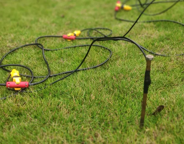
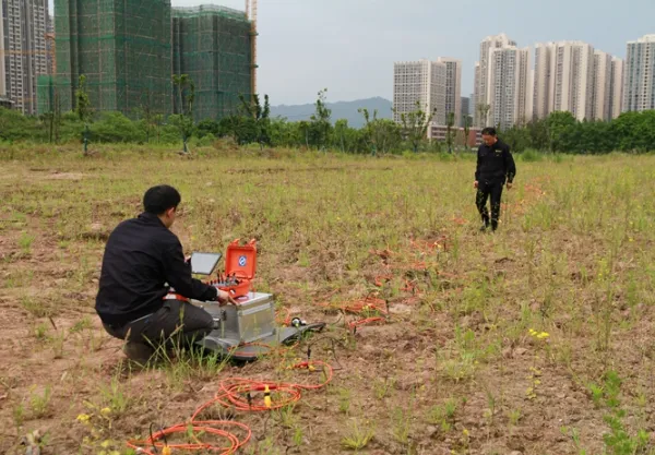
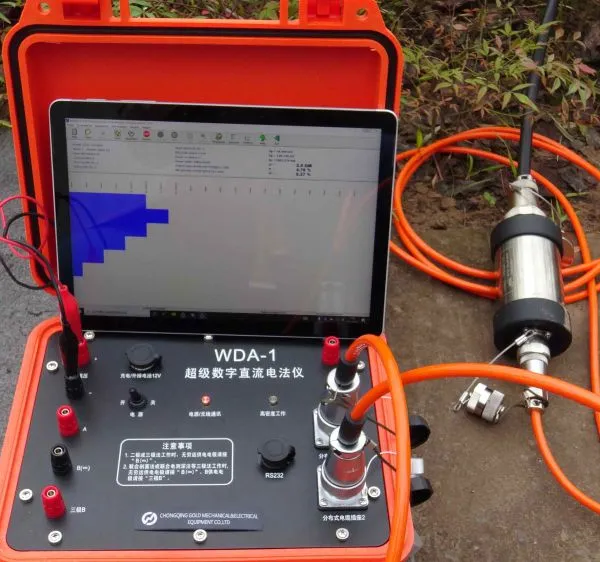



Related Products
-
 Geophone for Seismic Survey Seismic Sensor for Sale 4.5 Hz Geophone SensorNegotiableMOQ: 1 Set
 -
Industrial-grade Magnetotelluric Station CSAMT Transmitter-Compatible ReceiverNegotiableMOQ: 1 Set
-
Pumping Unit Wireline High Speed Perforating CableNegotiableMOQ: 1 Piece
-
Wireless Downhole Monitoring Self Leveling Pipeline CameraUS$ 1000MOQ: 1 Set
-
Guided Wave Radar Level Gauge Hydrostatic Level ProbeNegotiableMOQ: 1 Piece
Adaptive Exploration and Customized Investigation Architecture
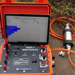
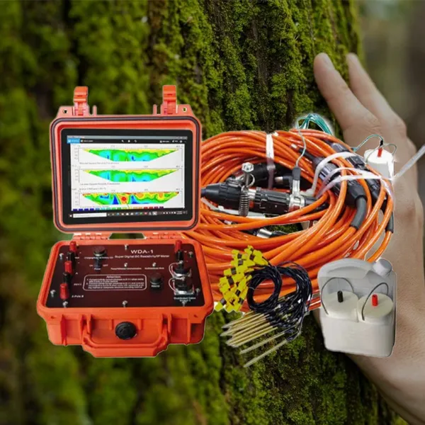
Modern geophysical challenges rarely conform to standardized measurement templates. Each exploration target presents unique characteristics, from the mineralogical composition of a sulfide deposit to the hydrogeological complexity of a coastal aquifer system. This imaging platform has been conceived as an adaptive exploration architecture, engineered not merely to perform measurements but to conform to the specific demands of each investigation scenario. Rather than imposing rigid operational constraints upon users, the system provides a flexible framework that enables geophysicists, geologists, and engineers to design and execute surveys that precisely address their unique objectives, whether those involve chasing subtle IP anomalies in rugged terrain or mapping intricate contaminant pathways beneath industrial facilities.
The system’s configurable transmitter architecture allows operators to tailor output characteristics to match the electrical properties of the survey area. When working in highly conductive environments such as clay-rich basins or saline coastal plains, the transmitter can deliver lower voltage, higher current profiles that maximize signal penetration while minimizing power consumption. Conversely, in resistive settings like crystalline basement terrains or permafrost regions, the unit shifts to higher voltage operation, ensuring adequate current flow through challenging ground conditions. This dynamic output adaptation is controlled through intuitive software parameters, enabling field crews to respond to changing subsurface conditions without halting operations or reconfiguring hardware connections.
Adaptive System Configuration Options
| Parameter | Adjustment Range | Application Context |
|---|---|---|
| Output Voltage | 50V to 1500V | Conductive soils require lower voltage; resistive rocks require higher voltage |
| Current Waveform | Square, duty cycle variable from 1 to 60 seconds | Shallow investigations benefit from rapid cycling; deep targets require longer pulse durations |
| Measurement Stacking | Automatic optimization based on real-time noise | Urban surveys need aggressive stacking; remote locations permit faster acquisition |
| Electrode Configuration | Wenner, Schlumberger, dipole-dipole, pole-dipole, custom arrays | Target geometry determines optimal array selection |
| Channel Assignment | 60 or 120 channels, configurable in the field | Large surveys maximize channel count; rapid reconnaissance may use fewer channels |
The multi-modal acquisition engine supports an extensive repertoire of measurement protocols, allowing the system to function effectively across the full spectrum of geophysical investigation domains. For mineral exploration, operators can engage deep-penetration IP modes that maximize sensitivity to disseminated sulfide mineralization at depths exceeding 600 meters. When investigating engineering sites, the system switches to high-resolution shallow modes that prioritize near-surface detail and rapid acquisition, producing images that resolve features as small as 0.5 meters in the upper 50 meters of the profile. Hydrogeological investigations benefit from specialized aquifer characterization protocols that optimize for mapping saturated zone geometry and estimating formation factor relationships.
Target-Specific Measurement Strategies
| Investigation Type | Optimized Configuration | Deliverable Outcome |
|---|---|---|
| Porphyry Copper Exploration | Deep IP with long pulse widths, widely spaced electrodes | 3D chargeability model identifying mineralized zones |
| Landfill Leachate Mapping | High-resolution resistivity, tight electrode spacing | Contaminant plume geometry and migration pathways |
| Dam Seepage Detection | Time-lapse resistivity with fixed electrode array | Differential maps showing evolving seepage patterns |
| Tunnel Route Assessment | Combined resistivity and seismic refraction, linear arrays | Geotechnical classification along proposed alignment |
| Archaeological Prospection | Ultra-high density arrays, 0.5m electrode spacing | Feature mapping at sub-meter resolution |
| Geothermal Resource Evaluation | Deep resistivity with broad lateral coverage | Resistivity structure indicating heat flow pathways |
The system’s customizable processing workflow extends adaptive capabilities beyond data acquisition into interpretation. Raw measurements can be exported in multiple formats compatible with industry-standard inversion software packages, while the integrated processing module provides application-specific inversion constraints that incorporate geological knowledge into the modeling process. For mineral exploration projects, chargeability data can be constrained by known mineralization models; for engineering investigations, resistivity inversions can incorporate borehole control to improve accuracy. This flexible interpretive framework ensures that final results reflect not only the measured data but also the accumulated knowledge and experience of the project geoscientist.
Electrode array customization represents another dimension of system adaptability. Beyond supporting all standard configurations, the platform enables users to design custom arrays tailored to specific target geometries and site constraints. When investigating linear features such as fault zones or buried channels, operators can deploy gradient arrays that optimize sensitivity along the feature trend. For site characterization around existing infrastructure, asymmetric arrays can concentrate investigation in accessible areas while maintaining adequate spatial coverage. The system’s software automatically calculates geometric factors for any user-specified electrode arrangement, eliminating the need for manual calculations or third-party tools.
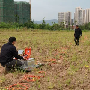
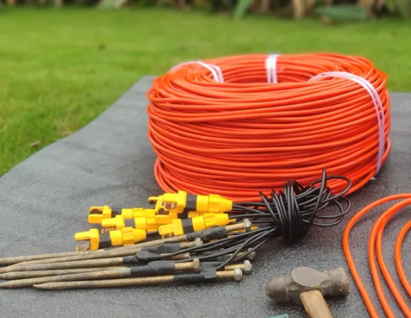
The modular hardware architecture supports deployment in challenging environments where standard approaches prove impractical. Submersible electrode cables enable underwater surveys for dam inspection, bridge foundation assessment, and marine archaeological investigation. Borehole-adapted electrode strings facilitate cross-hole tomography for resource definition and geotechnical characterization. Wireless electrode interfaces eliminate cable requirements in densely vegetated or hazardous terrain, while long-range cable systems accommodate surveys spanning kilometers in open terrain. This hardware flexibility ensures that measurement capability extends to wherever investigation requirements lead, without compromise imposed by equipment limitations.
Environmental adaptation features maintain measurement integrity across the full range of field conditions encountered in global geophysical practice. Temperature-compensated circuitry ensures measurement stability across the operational range from arctic to tropical environments, with calibration maintained despite temperature variations exceeding 50 degrees Celsius. Humidity-resistant enclosures protect sensitive electronics during surveys in tropical rainforests, coastal zones, and other high-moisture environments. Dust-sealed connectors maintain reliable electrical contact during desert operations where fine particulate matter can compromise conventional equipment. These environmental considerations transform the system from a laboratory instrument into a dependable field partner capable of delivering consistent results regardless of where investigation requirements lead.
Field Adaptation Features
| Environmental Challenge | System Solution | Operational Impact |
|---|---|---|
| Extreme Temperature | Wide operating range (-20°C to +60°C), minimal warm-up requirement | Year-round operation without seasonal limitations |
| High Humidity | Sealed electronics, conformal coating on circuit boards | Reliable performance in tropical and coastal environments |
| Dust and Sand | IP65-rated enclosure, sealed connectors | Continuous operation during desert field campaigns |
| Rough Terrain | Shock-resistant construction, reinforced cable assemblies | Equipment survives transport and deployment challenges |
| Remote Locations | Battery operation, solar charging compatibility | Extended surveys without generator support |
| Water Crossings | Submersible cables, waterproof electrode options | Investigation of river crossings and marine sites |
The software ecosystem supporting adaptive deployment includes project management tools that organize surveys by location, objective, and configuration parameters. Template systems allow users to save successful configurations for reuse on similar projects, reducing setup time and ensuring consistency across multiple surveys. Data management features associate acquisition parameters, field notes, and preliminary interpretations with raw measurement files, preserving context for future analysis and reporting. Collaboration tools enable team members to share configurations, processing workflows, and interpretation results, accelerating project completion and capturing institutional knowledge.
This emphasis on adaptive capability and customized investigation transforms the geophysical survey process from a standardized procedure into a tailored scientific inquiry optimized for each unique exploration target. Whether pursuing mineral resources in unexplored terrain, characterizing groundwater systems for community supply, assessing infrastructure sites for safety and reliability, or investigating environmental conditions for remediation planning, the platform adapts its capabilities to meet specific project requirements. The result is not merely data acquisition but focused intelligence gathering that addresses the precise questions driving each investigation, delivering actionable results that inform confident decision-making.

Send Inquiry to This Supplier


You May Also Like
-
2D Resistivity Imaging Equipment IP Survey System for MineralsNegotiableMOQ: 1 Set
-
Borehole Geophone Sensor Underground Seismic SensorNegotiableMOQ: 1 Set
-
Magnetic Surveying System Magnetic Survey EquipmentNegotiableMOQ: 1 Set
-
Underground Drilling Orientation Tool Portable Hole Alignment InstrumentNegotiableMOQ: 1 Set
-
Portable Geological Imager Subsurface Panoramic CameraNegotiableMOQ: 1 Piece
-
API 5CT Compliant Camera NIST Traceable Measurement CamNegotiableMOQ: 1 Set
-
SCADA Water Level Monitoring 4-20mA Water Level TransmitterNegotiableMOQ: 1 Piece
-
Archaeological Geophysics Resistivity Meter Landslide Monitoring Resistivity SystemNegotiableMOQ: 1 Set
-
Acceleration Canceling Hydrophone 10hz Natural Frequency HydrophoneNegotiableMOQ: 1 Set
-
Geophysical Industry Report Magnetic Survey Equipment RentalNegotiableMOQ: 1 Set
