

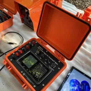
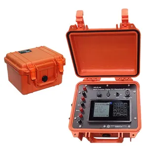
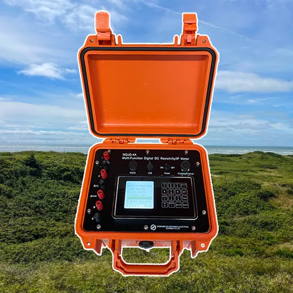
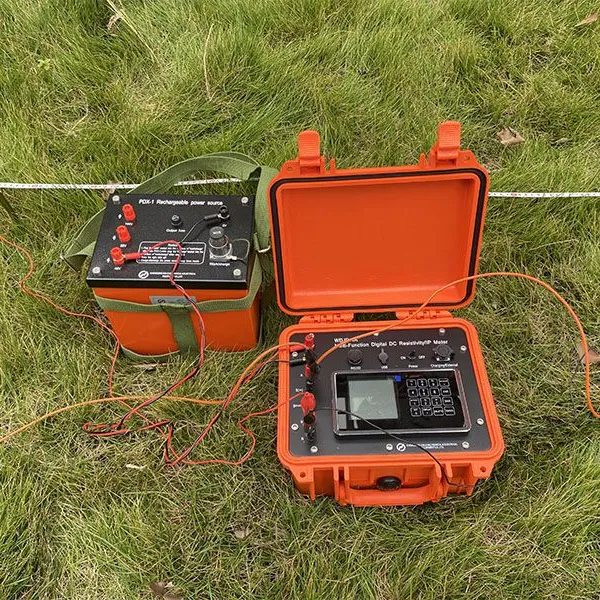
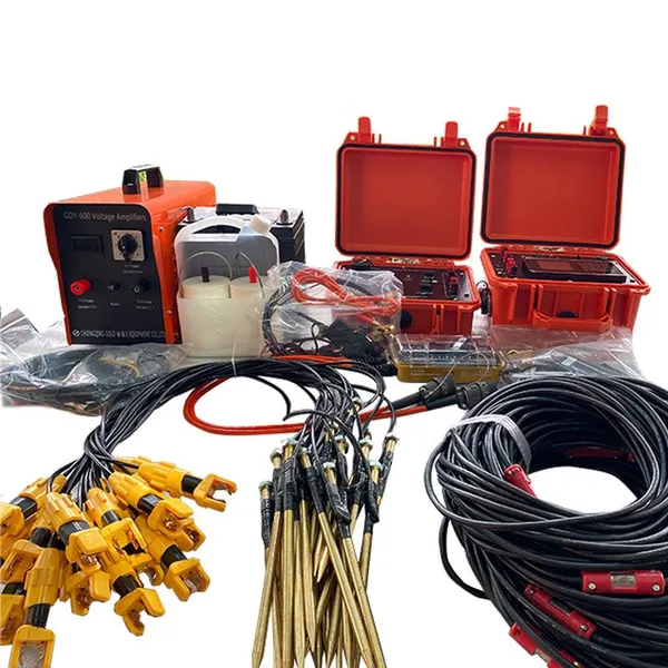
Resistivity Cable Testing System Time Domain IP Measurement System


Related Products
-
 Passive Source Seismic Sensor Borehole Seismic Sensor Node Seismic Sensor for Dam MonitoringUS$ 500MOQ: 1 Set
 -
ARM FPGA Data Acquisition System Remote Reference MT Station IP Resistivity Imaging EquipmentNegotiableMOQ: 1 Set
-
4-20mA Water Level Transmitter Sewage Level Sensor Liquid Level SwitchNegotiableMOQ: 1 Piece
-
SP Measurement System VES Resistivity Survey KitNegotiableMOQ: 1 Set
-
Seismic Impact System Geotechnical Seismic Source Surface Wave Seismic SourceUS$ 500MOQ: 1 Set
WDJD-4A: Creating Standardized, Trusted Data Products for a New Economy of Subsurface Information
Subsurface data has inherent value that extends far beyond a single project. Yet, this value remains largely untapped because data is collected in disparate formats, with variable quality, and without the provenance needed to establish trust in a commercial transaction. The WDJD-4A is engineered as a Geophysical Data Marketplace Enabler, a platform designed to produce standardized, certified, and transactable data products. It equips its users to participate in an emerging economy where high-quality subsurface information is a commodity that can be confidently bought, sold, licensed, or shared. By embedding rigorous quality standards, consistent formatting, and immutable provenance into every dataset, the WDJD-4A transforms raw geophysical measurements into valuable digital assets with clear ownership, verifiable quality, and predictable utility for secondary users.
The marketplace-enabling function is built on a foundation of data product standardization. The system's acquisition and processing workflows are designed to produce outputs that conform to emerging industry data standards, such as the Geophysics Data Standard (GDS) or formats compatible with major subsurface data repositories. Each data product is packaged with a machine-readable metadata header that fully describes its acquisition parameters, processing history, quality metrics, and usage rights. Crucially, the system incorporates a digital rights management framework that allows the data creator to embed licensing terms directly into the file structure, defining how the data may be used, shared, or resold. This transforms a simple data file into a self-enforcing contract, facilitating secure and automated transactions in a digital marketplace.
The strategic and economic implications are significant. For exploration companies, the ability to generate bankable, standardized data products creates a new revenue stream. Data acquired during regional reconnaissance can be packaged and sold or licensed to junior explorers, researchers, or government agencies, offsetting exploration costs and monetizing information assets that would otherwise sit idle. For service providers, it offers a powerful differentiator: clients are not just paying for a survey, but for a certified, transactable digital asset that retains value beyond the immediate project. For government geological surveys and data repositories, it provides a mechanism to efficiently ingest, catalog, and distribute high-quality subsurface data from diverse sources, accelerating the development of national and regional geoscience knowledge. The WDJD-4A Geophysical Data Marketplace Enabler thus positions its users at the forefront of a data-centric transformation of the geosciences, empowering them to capture, protect, and monetize the full value of their subsurface intelligence in a new, interconnected information economy.
Data Marketplace Specifications
| Marketplace Feature | Technical Capability & Economic Function |
|---|---|
| Standardized Data Product Generation | Automated creation of survey outputs conforming to industry data standards (e.g., Geophysics Data Standard) for seamless exchange. |
| Machine-Readable Metadata Packaging | Embedding of comprehensive, structured metadata (ISO 19115 compliant) enabling automated cataloging and discovery. |
| Digital Rights Management Integration | Framework for embedding licensing terms and usage restrictions directly into the data file structure. |
| Quality Certification Badging | Generation of verifiable quality metrics and certification badges indicating the data product's grade and reliability. |
| Marketplace Platform Connectivity | API integration capabilities for direct upload and listing of data products on emerging subsurface data marketplaces and repositories. |

Send Inquiry to This Supplier


You May Also Like
-
Geomagnetic Field Instrument High Speed Magnetometer Magnetic Field SensorNegotiableMOQ: 1 Set
-
Portable Logging Winch 3000m Logging Winch Borehole Downhole Logging WinchNegotiableMOQ: 1 Piece
-
Sewer Crawler Camera Price High Temp Borehole CameraNegotiableMOQ: 1 Set
-
Hydrostatic Level Sensor for Closed Tank Slurry Level Measurement SensorNegotiableMOQ: 1 Piece
-
Spectral IP Resistivity Imaging System Dual Mode IP/Resistivity SystemNegotiableMOQ: 1 Set
-
24 Channel Geophone Cable for MASW Mueller Takeout Seismic WireNegotiableMOQ: 1 Set
-
Marine Electromagnetic Receiver Geophysical Data Acquisition SystemNegotiableMOQ: 1 Set
-
Coring Wireline Cable Wireline Logging Tool CableNegotiableMOQ: 1 Piece
-
Rotary Head Borehole Camera Sewer Crawler Camera PriceNegotiableMOQ: 1 Set
-
Borehole Water Level Data Logger Radar Level Measurement Hydroponic Water Level ControllerNegotiableMOQ: 1 Piece
