

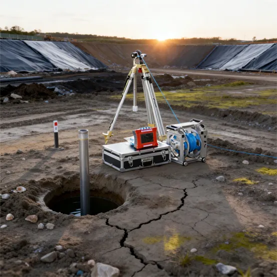
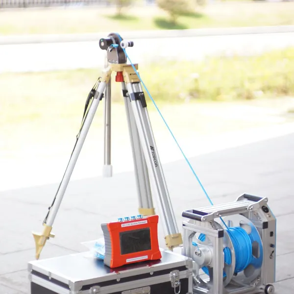
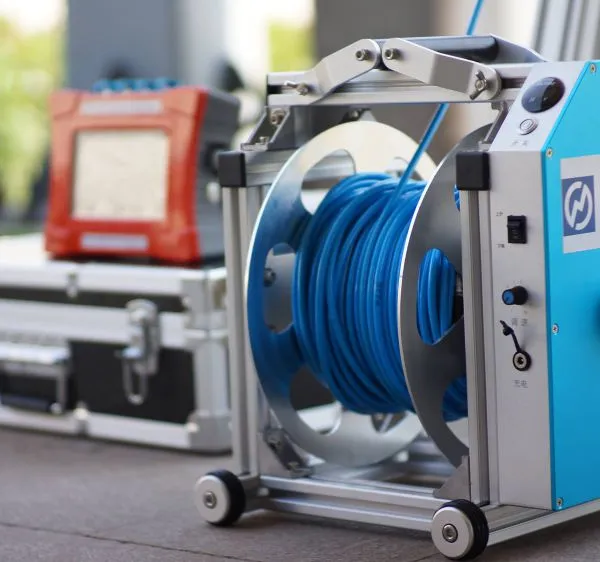
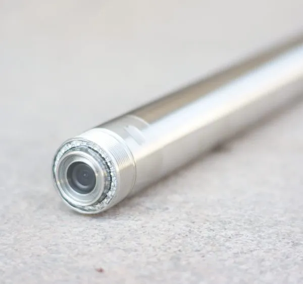
Geological Drillhole Inspector Mining Drillhole Imager Equipment


Related Products
-
 Deep Water Well Inspection Camera Underground Underwater Borehole Inspection CameraUS$ 1 - 1MOQ: 1 Piece
 -
360 Degree Rotation Underwater Deep Water Well Inspection CameraUS$ 1 - 1MOQ: 1 Piece
-
Waterproof Underwater Manhole and Borehole Inspection CameraUS$ 1 - 1MOQ: 1 Piece
-
Borehole Water Well Inspection CCTV Camera Well LoggerNegotiableMOQ: 1 Piece
-
Resistivity Calibration Instrument Geophysical Resistivity Sensor Array Resistivity Data LoggerNegotiableMOQ: 1 Set
The Subsurface Asset Lifecycle Management Platform
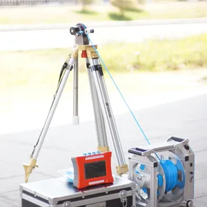
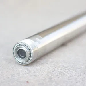
Infrastructure assets—dams, tunnels, mines, foundations—evolve over decades. Their initial condition, rate of deterioration, and remaining service life are critical unknowns for owners and operators. The GD-C1201 Intelligent Drillhole Optical Imager serves as a lifecycle management platform, providing baseline documentation, periodic reassessment, and change-detection capabilities that enable informed maintenance, rehabilitation, and end-of-life decisions. This system turns borehole data into a living record that follows an asset from construction through operation to eventual decommissioning.
Baseline Establishment and Archival
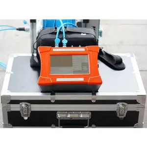
At project inception, the system captures comprehensive baseline imagery of all foundation boreholes, documenting rock quality, fracture networks, and geological discontinuities with permanent digital precision. These records are stored in the TENSENSE2010 database with full metadata—project name, borehole ID, date, collar coordinates, and equipment configuration. The baseline serves as the reference condition against which all future inspections are compared. Unlike photographic prints or paper logs that fade or get lost, the digital archive remains accessible, searchable, and shareable across teams and generations of asset managers.
Periodic Re-inspection and Change Detection
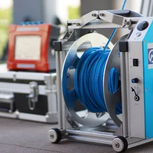
The system's high repeatability enables precise re-location of inspection points. The depth encoder and compass ensure that the same borehole section can be found years later, and the image can be overlaid with the baseline to highlight changes—new cracks, widening apertures, infilling by secondary minerals, or signs of structural displacement. The software's brightness/contrast adjustment and image rotation tools compensate for minor variations in lighting or probe rotation, ensuring that comparison is valid. This capability supports condition-based monitoring programs, where maintenance is triggered by observed deterioration rather than fixed schedules, optimizing resource allocation.
Technical Specifications: The Lifecycle Toolkit
| Lifecycle Phase | System Feature | Asset Management Value |
|---|---|---|
| Construction (Baseline) | High-resolution panoramic imaging; full depth coverage; export to PDF/JPG for records. | Creates irrefutable as-built documentation that validates design assumptions and supports warranty claims. |
| Operation (Monitoring) | Repeatable survey protocols; depth/orientation repeatability; image overlay capability. | Enables trend analysis of deterioration (crack growth, weathering advance), allowing proactive intervention. |
| Maintenance (Inspection) | Quick-deploy portable unit; battery-powered; no external requirements. | Facilitates low-cost periodic inspections without disrupting operations, increasing inspection frequency. |
| Decommissioning (Final Record) | Database archiving; export to universal formats; audit trail. | Provides final condition documentation for regulatory closure and liability transfer. |
Case Studies in Asset Stewardship
For a hydroelectric dam, the GD-C1201 inspects drainage galleries and foundation boreholes to track seepage paths and fracture evolution, enabling engineers to plan grouting campaigns based on actual conditions. In a deep underground mine, the system monitors roof-bolt boreholes to detect bed separation and crack propagation, triggering reinforcement before fall-of-ground incidents. For a bridge foundation, periodic scans of pile sockets document any change in rock-socket contact or surrounding material, informing load rating and remaining capacity estimates. In each case, the system provides actionable intelligence that extends asset service life and reduces catastrophic failure risk.
The Asset Manager's Verdict
The GD-C1201 empowers infrastructure owners to manage subsurface assets with the same rigor as surface structures. It provides the historical context and objective evidence needed to prioritize maintenance budgets, justify capital expenditures, and defend against liability claims. By establishing a permanent digital memory of the subsurface, this system transforms boreholes from a one-time investigation cost into a lasting investment in asset intelligence, paying dividends throughout the entire service life of the project.

Send Inquiry to This Supplier

You May Also Like
-
Mineral Exploration Data Interpretation Geophysical Prospecting Consulting Service Underground Cavity Detection SystemNegotiableMOQ: 1 Set
-
Multi Functional Pipe Inspection Camera Wireless Drain Inspection Camera Monitor High Pressure Waterproof Borehole CameraNegotiableMOQ: 1 Set
-
Resistivity Cable Testing System Time Domain IP Measurement SystemNegotiableMOQ: 1 Set
-
Passive Source Seismic Sensor Borehole Seismic Sensor Node Seismic Sensor for Dam MonitoringUS$ 500MOQ: 1 Set
-
ARM FPGA Data Acquisition System Remote Reference MT Station IP Resistivity Imaging EquipmentNegotiableMOQ: 1 Set
-
4-20mA Water Level Transmitter Sewage Level Sensor Liquid Level SwitchNegotiableMOQ: 1 Piece
-
SP Measurement System VES Resistivity Survey KitNegotiableMOQ: 1 Set
-
Seismic Impact System Geotechnical Seismic Source Surface Wave Seismic SourceUS$ 500MOQ: 1 Set
-
Geomagnetic Field Instrument High Speed Magnetometer Magnetic Field SensorNegotiableMOQ: 1 Set
-
Portable Logging Winch 3000m Logging Winch Borehole Downhole Logging WinchNegotiableMOQ: 1 Piece


