

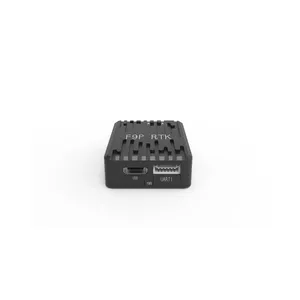
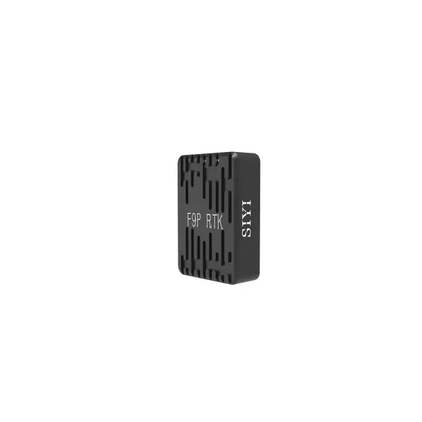
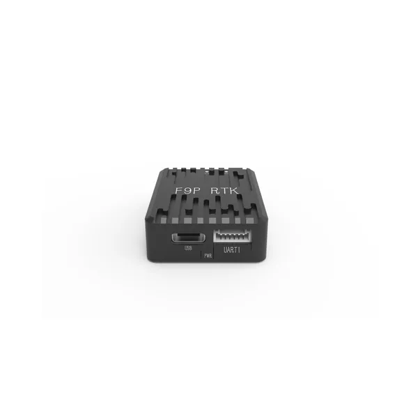
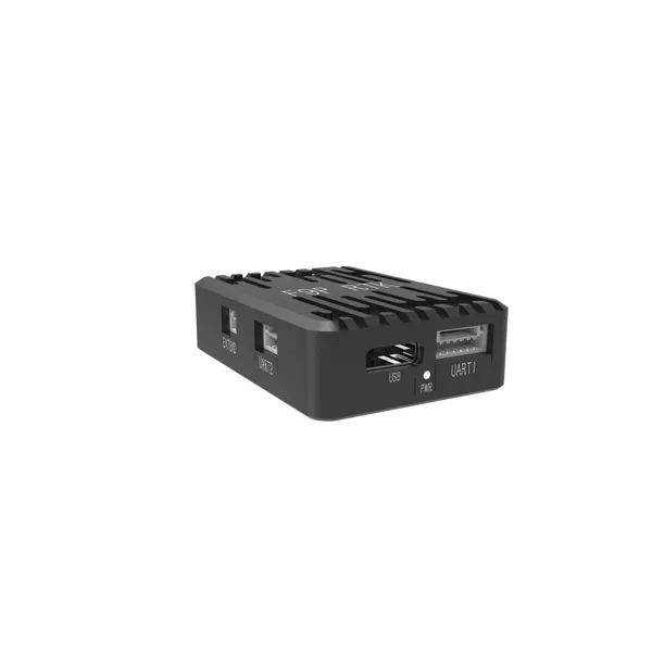
GeoAccurate F9P RTK Rover Positioning Module


Related Products
-
 N7 Autopilot Flight CoreUS$ 429 - 489MOQ: 1 Piece
 -
N7 Flight Controller + Power + GPS Integrated SetUS$ 559 - 579MOQ: 1 Set
-
Siyi RTK Positioning & Orientation ModuleUS$ 419 - 459MOQ: 1 Piece
-
PowerCore Hall Effect Power ModuleUS$ 71 - 89MOQ: 1 Piece
-
GeoAccurate F9P RTK Base Station Positioning ModuleUS$ 534 - 579MOQ: 1 Set
GeoAccurate F9P RTK Rover Positioning Module - Detailed Product Description
Model Number: GeoAccurate F9P RTK Rover Positioning ModuleCore Positioning: A high-performance GNSS rover positioning terminal, designed to work with RTK base stations, delivering centimeter-level high-precision positioning services for outdoor operation scenarios such as surveying and mapping, agriculture, and infrastructure construction.
I. Core Advantages
-
Centimeter-level High-precision Positioning, Error-free Operations
Equipped with a flagship F9P positioning chip, it supports multi-frequency signal reception from four global satellite navigation systems: GPS, BDS, GLONASS, and Galileo. Combined with differential data from the base station, it achieves ultra-high positioning accuracy of ±1cm + 1ppm horizontally and ±2cm + 1ppm vertically in dynamic mode. It can accurately meet the millimeter-level requirements of engineering lofting and the path planning needs of agricultural machinery navigation, eliminating rework caused by positioning deviations.
-
Ultra-fast Differential Calculation, Ready for Operation Immediately After Startup
Built-in the new-generation differential algorithm, it features a cold start time of ≤20 seconds, a hot start time of ≤1 second, and RTK initialization completed in as fast as 3 seconds. The device can be put into operation right after startup without long waiting time. It also supports three differential data receiving methods: radio, 4G, and Wi-Fi, with a maximum communication distance of up to 10 kilometers, ensuring stable signal transmission without interruption in complex environments.
-
Superior Environmental Adaptability, Stable Operation Around the Clock
The fuselage adopts a high-strength engineering plastic + aluminum alloy frame design with an IP67 protection rating, capable of withstanding harsh outdoor environments such as rainy days, sand and dust, and high temperature and humidity. The operating temperature range covers -40℃~+85℃. Whether it is surveying in the frigid northern winters or farmland operations in the scorching southern summers, the device performance remains unaffected, ensuring all-day continuous work.
-
Lightweight and Portable Design, Easy Installation and Maintenance
With a total weight of only 200g and a compact size, it supports two installation methods: embedded and external. It can be directly integrated into surveying controllers, agricultural machinery controllers, and other equipment. Equipped with standard interfaces, it realizes plug-and-play functionality without complex wiring; it also supports online firmware upgrades, allowing remote function updates and reducing later maintenance costs.
II. Application Scenarios
Engineering Surveying and Mapping: Topographic surveying, cadastral surveying, road and bridge lofting, construction setting-out
Smart Agriculture: Agricultural machinery automatic driving, variable-rate fertilization and seeding, precision crop protection in farmland
Geographic Information Collection: Land survey, natural resource monitoring, GIS data acquisition
Industrial Applications: Mobile robot navigation, logistics and warehousing positioning, power inspection path planning

Send Inquiry to This Supplier


You May Also Like
-
UniRC 10 Pro Professional UAV Ground Control Station - 3-Frequency Redundancy Complete KitUS$ 3239 - 3709MOQ: 1 Set
-
UniRC 7 Pro 40KM Ultra-long Range Dual-band Ground Station, 1600 Nits HD Touch ControllerUS$ 1469 - 1719MOQ: 1 Set
-
MK32 Industrial-Grade Dual-Operator HD Video Transmission LinkUS$ 654 - 979MOQ: 1 Set
-
MK15E Industrial Version Intelligent Carrier Handheld Ground StationUS$ 679 - 829MOQ: 1 Set
-
MK15 Plant Protection Version Agricultural Operation Control TerminalUS$ 569 - 749MOQ: 1 Set
-
A2MINI Pocket-Sized Surveillance Micro PodUS$ 159.9 - 179.9MOQ: 1 Piece
-
A8MINI Compact HD Micro Surveillance PodUS$ 409 - 429MOQ: 1 Piece
-
ZR10 Lightweight Anti-Shake Fixed-Focus PodUS$ 929 - 949MOQ: 1 Piece
-
ZR30 Starlight Night Vision Zoom PodUS$ 2119 - 2139MOQ: 1 Piece
-
MiniTherm ZT6 4K Dual-Camera MountUS$ 2659 - 2859MOQ: 1 Piece


