

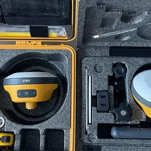
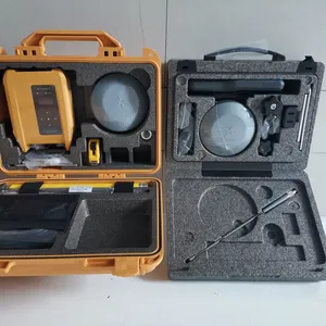
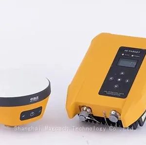
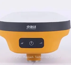
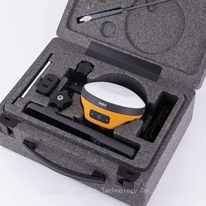
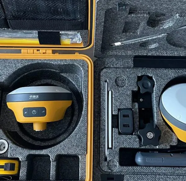
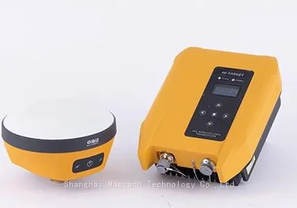
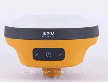
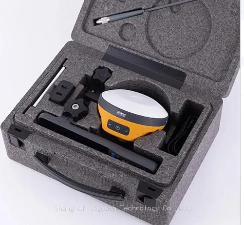
Hi Target GPS V200 GNSS RTK Receiver With Tilt Sensor

Related Products
-
 Hi Target GPS V200 GNSS RTK Receiver With Tilt SensorUS$ 2800 - 3000MOQ: 1 Set
 -
V30 GPS RTK ,gnss, RTK GPSNegotiableMOQ: 1 Set
-
RTK GPS GNSS Navigator GNSS RTK Instrument for SaleUS$ 2500 - 4000MOQ: 1 Set
-
H32 GNSS RTK GPSUS$ 1 - 10MOQ: 1 Set
-
IP67 GNSS RTK GPS Waterproof High Precision GNSS RTK AntennaUS$ 59.5 - 70.5MOQ: 10 Pieces
Key Features :
1. The new IMU can be measured by shaking it
2. Built-in integrated battery
3. Fast charging, can be fully charged in 1 hour
4.Small size, easy to carry
Higher Accuracy and PrecisionEquipped with the High-Performance Patch Antenna,
enhances the low elevation angle tracking capabilities
and keeps it maintaining a high gain
for higher elevation satellites while tracking low-elevation satellites.
Hi-Target Hi-Fix enables continuous connectivity and quality results even if you lose the signal while using the RTK base station or VRS network under extreme circumstances.Greater Flexibility
It can bring accurate and reliable results
and boost efficient fieldwork with
self-developed built-in IMU and core algorithm.
V200 specification |
||
Channels |
660 |
|
Satelite Tracked |
GPS:L1/ L2/ L5/L2C |
|
BeiDou:B1/ B2/ B3/B1C/B2a |
||
GLONASS: L1/L2/L3 |
||
Galileo:E1/ E5 AltBOC/E5a/E5b/E6 |
||
QZSS:L1/L2/L5/L6 |
||
SBAS: L1/ L5 |
||
IRNSS:L5 |
||
Static and Fast static Gnss Surveying |
||
Horizontal |
± (2.5+0.5× 10⁻⁶d) mm (D is the distance between measured points) |
|
Vertical |
± (5+0.5× 10⁻⁶d) mm (D is the distance between measured points) |
|
Post Processing Kinematic (PPK / Stop & Go ) GNSS Surveying |
||
Horizontal |
8mm+1ppm RMS |
|
Vertical |
15mm+1ppm RMS |
|
Initialization time |
Typically 10 min for base while 5 min for rover |
|
Initialization reliability |
typically > 99.9% |
|
High-precision static GNSS Surveying |
||
Horizontal |
±(8+1×10¯6D)mm (D is the distance between measured points) |
|
Vertical |
:±(15+1×10¯6D)mm D is the distance between the measured points |
|
Code Differential GNSS Positionnig |
||
Horizontal |
±0.25m + 1 ppm RMS |
|
Vertical |
±0.25m + 1 ppm RMS |
|
SBAS |
||
Positioning accuracy |
0.50m Horizontal, 0.85m Vertical |
|
Real Time Kinematic (RTK) |
||
Single Base |
Horizonta:8mm+1ppm RMS |
|
Vertica:15mm+1ppm RMS |
||
Network RTK |
Horizonta:8mm+0.5ppm RMS |
|
Vertical:15mm+0.5ppm RMS |
||
Initialization time:Typically |
||
Initialization reliability:Typically > 99.9% |
||
Communication |
||
Internal UHF Radio |
Frequency: 410-470MHz |
|
Channels:116 (16 adjustable) |
||
Transmitting power:0.5W,1W,2W |
||
agreement:Hi-Target, Trimtalk450S, trimmarkIII, Transeot, SATEL-3AS,South,CHC,ect |
||
Working Range:3-5km typical, 8-10km optimal |
||
HI-TARGET External UHF Radio(Standard) |
Frequency: 403-473MHz |
|
Transmitting speed:Up to 19.2Kbps |
||
Channels:116 (16 adjustable) |
||
5W,10W,20W,30W adjustable |
||
Working Range:8~10km typical,15~20km optimal |
||
IMU(Tilt Survey) |
Built-in high-precision inertial navigation, automatic attitude compensation, no correction, anti-magnetic interference, instant measurement at the point of arrival; |
|
Network Communication |
||
Full band support for cellular mobile network(LTE, WCDMA, EDGE, GPRS, GSM) 2.4GHz WIFI, supports 802.11b/g/n. Network RTK (in CORS) range is 20-50km |
||
Physical |
||
Dimensions(W×H) |
132mm*67mm |
|
Weight |
≤0.83kg (includes battery) |
|
Shock and vibration |
Designed to survive a 2m(9.84ft) natural fall onto concrete |
|
Water/Dustproof |
IP67 |
|
Humidity |
100% condensing |
|
Operation temperature |
-30ºC~+70ºC |
|
Storage temperature |
-40ºC~+80ºC |
|
Bluetooth |
2.1+4.0 |
|
NFC |
NFC flash even |
|
A serial port |
RS232 serial port |
|
Control Panel |
Physical button |
|
Energy consumption and working hours |
||
Electrical |
Power 6V to 28V DC external power input |
|
Power consumption≤4.2W |
||
Built-in high-capacity lithium battery 6800mAh/7.4V, support USB PD3.0 super fast charging, charging time |
||
Internal Battery Life |
Static more than 10 hours |
|
RTK rover (UHF/GPRS/3G)6-10 hours |
||
RTK base more than 10 hours |
||
Data Formats |
||
1Hz positioninng Output, up to 50Hz. CMR, RTCM2.X, RTCM3.0, RTCM3.1, RTCM3.2. Navigation outputs ASCII NMEA-0183, GSV, AVR, RMC, HDT, VGK, VHD, ROT, GGK, GGA, GSA,ZDA, VTG, GST, PJT, PJK, BPQ, GLL, GRS, GBS, Binary: Trimble GSOF, NMEA2000 |
||

Send Inquiry to This Supplier


You May Also Like
-
Waterproof & Dustproof GNSS RTK System With GPS/GNSS SignalsUS$ 1000 - 5000MOQ: 1 Set
-
GNSS RTK Gps Receiver Machine Control M300CUS$ 1,899 - 3,199MOQ: 1 Unit
-
CHC X91+ Gnss Rtk Gps Group Dual Frequency Satellite ReceiverUS$ 8,500 - 11,000MOQ: 1 Piece
-
BL-5000 Li Battery for Haida V30,F61,V50,F66 GNSS RTK GPSNegotiableMOQ: 1 Unit
-
Buy a Cheap Gnss Gps Rtk Surveying Rtk Gnss X900US$ 9,999 - 10,000MOQ: 1 Piece
-
Engineering Surveying Unistrong G970II Gps Rtk GNSS RtkUS$ 2800 - 3000MOQ: 1 Set
-
FURUNO GNSS NAVIGATOR GP-170/000-026-990-00US$ 500 - 800MOQ: 1 Piece
-
Low Power Gsm Module Gps Gnss Antenna Sim33eau Smallest Gps Gnss Rtk Tracker Electronic Components and SuppliesUS$ 25 - 100MOQ: 1 Piece
-
Tracking Gps Rs232 Chip Inside GNSS GPS AntennaUS$ 1.5 - 4MOQ: 100 Pieces
-
SURVEYING INSTRUMENT: GPS POLE,ALUMINIUM GPS POLE,ALUMINIUM RTK POLEUS$ 36 - 39MOQ: 1 Piece

