

Low Cost GNSS Aided MEMS Inertial Navigation System
Related Products
-
 High-precision MEMS Integrated Navigation SystemNegotiableMOQ: 1 Piece
 -
Mapping-level & Ultra-precision GNSS/MEMS Inertial Navigation SystemNegotiableMOQ: 1 Piece
-
Cost Effective Attitude Control MEMS IMUNegotiableMOQ: 1 Bag
-
High Performance Dynamic FOG North SeekerNegotiableMOQ: 1 Piece
-
Economical MEMS North SeekerNegotiableMOQ: 1 Piece
Introduction
1. Attitude accuracy: 0.1° (0.03° post-processing), heading accuracy: 0.1° (0.05° post-processing).
2. Built-in full-band full-system dual-antenna positioning and orientation GNSS module.
3. Variety of data interface, support RS422/RS232 and CAN.
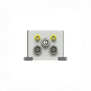
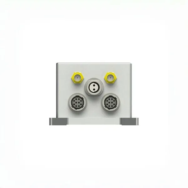
ER-GNSS/MINS-05 is a cost-efficient GNSS aided MEMS INS with a highly reliable MEMS inertial measurement unit and a dual-antenna full-system full-band positioning and directional satellite module. The integrated navigation fusion algorithm can provide continuous, accurate and reliable positioning, attitude and speed information. It has a variety of communication interfaces and provides standardized user communication protocols, which can meet the aviation, land, Marine and other applications.
Features
High reliability and low cost MEMS gyroscope (zero bias instability
Built-in full-band full-system dual-antenna positioning and orientation GNSS module, supporting single-antenna high-precision positioning and velocity measurement, supporting dual-antenna fast orientation function.
The system can provide accurate integrated navigation information, attitude up to 0.1°, post-processing 0.03°, heading 0.1°, post-processing 0.05°.
Variety of data interface, more easy to install and use, support RS422/RS232 and CAN.
Precision aluminum alloy shell, high reliability, can be widely used in land, aviation, navigation
Application areas
UAV, flight recorder, intelligent unmanned vehicle,
Roadbed positioning and orientation, channel detection,
Unmanned surface vehicle, underwater vehicle.
Specifications
1. system parameter
| ER-GNSS/MINS-05 | |
| Roll & Pitch Accuracy | 0.1° |
| 0.03°(Post Processing) | |
| Heading | 0.1° Dual Antenna GNSS(baseline 1m) |
| 0.05°(Post Processing) | |
| Speed accuracy | 0.03m/s |
| Supply Voltage | 6~12V |
| Supply Consumption | 4W |
| Interface | 1Way-RS422 or 1Way-RS232 and 1Way-CAN |
| Vibration | 6.06g |
| Shock | 5000g,0.1ms |
| Operate Temp | -40℃~+80℃ |
| Storage Temp | -55℃~+95℃ |
| Weight | |
| Size | 65mm*70mm*45.5mm |
2. Sensor parameter
| Gyro Performance | ||
| Item | Parameter | Unit |
| Range | ±450 | deg/s |
| Bandwidth | ≥150 | Hz |
| Bias stability (1σ) | ≤8 | deg/hr |
| Bias Instability (1σ) | ≤2 | deg/hr |
| Angular Random Walk | ≤0.15 | °/ √h |
| Scale Factor Non-Linearity | ≤50 | ppm |
| Bias Run-Run (1σ) | ≤8 | deg/hr |
| Accelerometer Performance | ||
| Item | Parameter | Unit |
| Range | ±15 | g |
| Bandwidth | ≥150 | Hz |
| Bias stability (1σ) | 0.1 | mg |
| Bias Instability (1σ) | 0.025 | mg |
| Angular Random Walk | 0.025 | m/s/ √h |
| Scale Factor Non-Linearity | 200 | ppm |
| Bias Run-Run (1σ) | 0.1 | mg |
| Barometer | ||
| Parameter | value | Unit |
| Pressure range | 450~1100 | mbar |
| 50~1200 | mbar | |
| Overall error | 6 | |
| Long-term stability | 1 | mbar/year |
| Magnetometer | ||
| Dynamic measurement range | ±2 | gauss |
| Sensitivity | 0.1 | mgauss/LSB |
| Initial sensitivity error | 2 | % |
| Sensitivity temperature coefficient | 250 | ppm/℃ |
| Initial bias error | 400 | mgauss |
| Partial temperature coefficient | 0.7 | mgauss/℃ |
| Output noise | 4 | mgauss |
| Noise density | 1 | maguss/ √h |
| Bandwidth | 50-200 | Hz |
| GNSS | |||||||
| Supported Navigation System | BDS/GPS/GLONASS/Galileo/QZSS | ||||||
| Main ANT Frequency | BDS:B1L, B2L, B3L GPS:L1C/A, L2P(Y)/L2C, L5 GLONASS: L1, L2 Galileo: E1, E5a, E5b QZSS: L1, L2, L5 |
||||||
| Slave ANT Frequency | BDS:B1L, B2L, B3L GPS:L1C/A, L2C GLONASS: L1, L2 Galileo: E1, E5b QZSS: L1, L2 |
||||||
| Position Accuracy (RMS) | Single point positioning | Horizontal | 1.5m | ||||
| Altitude | 2.5m | ||||||
| DGPS | Horizontal | 0.4m+1ppm | |||||
| Altitude | 0.8m+1ppm | ||||||
| RTK | Horizontal | 0.8cm+1ppm | |||||
| Altitude | 1.5cm+1ppm | ||||||
| Accuracy of observation (RMS) | |||||||
| BDS | GPS | GLONASS | Galileo | ||||
| B1I/L1 C/A/G1/E1 pseudo-range | 10cm | 10cm | 10cm | 10cm | |||
| B1I/L1 C/A/G1/E1 Carrier Phase | 1mm | 1mm | 1mm | 1mm | |||
| B3I/L2P(Y)/L2C/G2 pseudo-range | 10cm | 10cm | 10cm | 10cm | |||
| B3I/L2P(Y)/L2C/G2 Carrier Phase | 1mm | 1mm | 1mm | 1mm | |||
| B2I/L5/E5a/E5b pseudo-range | 10cm | 10cm | 10cm | 10cm | |||
| B2I/L5/E5a/E5b Carrier Phase | 1mm | 1mm | 1mm | 1mm | |||
| Time accuracy (RMS) | 20ns | ||||||
| Speed accuracy (RMS) | 0.03m/s | ||||||
| First positioning time | |||||||
| Initialization time | |||||||
| Data update rate | |||||||

Send Inquiry to This Supplier


You May Also Like
-
Cost-Efficient Triaxial MEMS North SeekerNegotiableMOQ: 1 Piece
-
Dual Axis MEMS GyroscopeNegotiableMOQ: 1 Piece
-
Economical MEMS GyroscopeNegotiableMOQ: 1 Piece
-
High Accuracy MEMS AccelerometerNegotiableMOQ: 1 Piece
-
Low Cost 3 Axis FOG North SeekerNegotiableMOQ: 1 Unit
-
High Precision Wireless Transmission Tilt SensorNegotiableMOQ: 1 Piece
-
High Performance Wireless Transmission Tilt SensorNegotiableMOQ: 1 Unit
-
Low Cost Digital Output Single Axis Tilt SensorNegotiableMOQ: 1 Unit
-
Smallest Size Triaxial MEMS North SeekerNegotiableMOQ: 1 Unit
-
Current Type Dual-Axis Tilt SensorNegotiableMOQ: 1 Unit


