

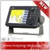
12 Inch Marine GPS Chartplotter


Related Products
-
 5.6 Inch Marine GPS Chartplotter With Echo Sounder ComboNegotiableMOQ: 1 Piece
 -
12 Inch Marine GPS/AIS Chart PlotterNegotiableMOQ: 1 Piece
-
12 Inch Marine GPS Chartplotter KP-1299NegotiableMOQ: 1 Piece
-
Marine GPS Fish Finder ComboNegotiableMOQ: 1 Piece
-
Marine GPS Receiver AntennaNegotiableMOQ: 10 Pieces
ONWA®
12" TFT LCD GPS CHART PLOTTER
MODEL: KP-1299
FEATURE:
1. High resolution 12 inches day-view LCD display
2. SD-cards slot for C-map Max and user data
3. C-map Max and K-chart Selectable
4. Tide table
5. Versatile display modes including:
- Plotter Screen
- Nav Data
- Satellite Information
- AIS Display
- Compass Screen
6. GOTO Track Navigation
7. Map Orientation Select
8. Proximity waypoint alarms
9. Perspective View
10. Palette
- Normal
- Daylight - Exposed to Sunlight
- Night - In Dark Environment
- NOAA - Paper Chart Colors
SPECIFICATIONS
Plotter Characteristics
1. Waypoints/Icons: 15,000 waypoints with name, symbol, 10 proximity waypoint.
2. Route Memory: waypoint up to 200 points each, plus MOB and Track Navigator or Goto track modes
3. Alarm: XTE, Anchor Drag, Arrival, Speed, Voltage, Proximity, Waypoint and Time, AIS alarm.
4. PALLETE
- Normal
- Daylight: Exposed to sunlight
- Night: In dark environment
- NOAA: Paper chart color
5. Tides: Tide Data
6. Projection: Mercator projection
7. Position format: Lat/Lon
8. Base Map: Built-in ONWA K-Chart
9. External Map: SD cards slot for user settings
10. User data storage: Internal backup of user settings, or external SD-card
11. Plot Interval: 1s to 99h or 0.01nm to 9.99nm
12. 0.01nm to 1,000nm
GPS Receiver Characteristics
1. Receiver: 12 parallel channel GPS receiver continuously Tracks and uses up to 12 satellites to compute and update your position
2. Acquisition: Cold start: 60 seconds average
Warm start: 45 seconds average
Hot start: 15 seconds average
3. Update rate: 1/second, continuous
4. Accuracy: Position: <15 meters(95%) without S/A
Velocity: 0.1 meter/sec without S/A
Time: ±100ns synchronized to GPS time
5. Dynamics: Altitude: 18,000m Max
Velocity: 500 m/s
Acceleration: 4g Max
6. Datum: WGS 84 & Others
7. Interface: NMEA 0183 Input and Output, RS232 and RS422 output
8. Antenna: KA07
AIS Interface
Data input: NMEA 0183, RS232 or RS422
Baud rate: 38400
Power Supply
10.5 to 35VDC, current drain < 300mA at 12V
Physical
1. Display: 12-inches color TFT day-view LCD, 640 x 480 pixels
2. Waterproofing: Display unit: IPX5; Antenna unit: IPX6
3. Temperature: -15°C to + 55°C (Display unit); -25°C to + 70°C (GPS antenna)
Equipment List (Standard)
- Display unit
- Antenna unit with 10m cable
- Operator manual
- Installation materials
- Standard spare parts

Send Inquiry to This Supplier


You May Also Like
-
Matsutec 4.3inch Marine GPS/SBAS NavigatorNegotiableMOQ: 1 Piece
-
HP-528 4.3" LCD GPS Marine Navigator for ShipUS$ 150 - 170MOQ: 1 Piece
-
Matsutec AIS Fishing Net LocatorNegotiableMOQ: 1 Piece
-
ONWA Marine Auto Pilot for BoatsUS$ 780 - 780MOQ: 1 Piece
-
Satellite Phone Iridium 9555NegotiableMOQ: 1 Piece
-
High Gain Marine GPS Antenna for ChartplotterNegotiableMOQ: 10 Pieces
-
10.4 Inch Color LCD Marine Radar With AIS DisplayNegotiableMOQ: 1 Piece
-
Dock Station for Satellite Phone Isatphone ProNegotiableMOQ: 1 Piece
-
Satellite Data Indoor Amplifier TerminalNegotiableMOQ: 1 Piece
-
64nm Marine Radar With AIS Display FunctionNegotiableMOQ: 1 Piece

