Home > Products > Geophysical Exploration Equipment > RTK high-accuracy internal radio GNSS GPS
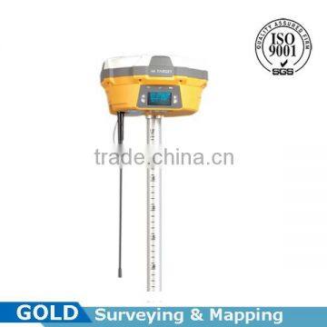
RTK high-accuracy internal radio GNSS GPS
- 100 Set / Sets per Month
- Chongqing China
- T/T

You May Like
-
 High-accuracy Data Auto-recorded RTK GNSS/GPS Rover Set
-
Acurrate testing auto-compensation resistivity metal finder water finder
-
High-accuracy Absolute Ecoding Total Station
-
Accurate testing resistivity direct-reading underground water finder
-
Data Automatically Recorded Base and Rover RTK GNSS/GPS Surveying System
-
Advanced VF Frequency Adjustable Marine Echo Sounder
Product Details
| Use | Automotive | Function | Other, internal radio | |
| Place of Origin | Chongqing, China | Brand Name | GOLD | |
| Model Number | VG60 | Warranty | 1 Years |
Product Description
RTK high-accuracy internal radio GNSS GPS
Measurement:
1. 220 channels
2. Advanced Pacific Crest Maxwell 6 Custom Survey GNSS Technology.
3. High precision multiple correlator for GNSS pseudo range measurements.
4. Unfiltered, unsmoothed pseudo range measurement data for low noise, low multipath error, low time domain correlation and high dynamic response.
5. Very low noise GNSS carrier phase measurement with <1 mm precision in a 1 Hz bandwidth
6. Signal-to-noise ratios reported in dB-Hz
7. Proven Pacific Crest low elevation tracking technology.
Satellites Signals Tracking Simultaneously:
GPS...................................Simultaneous L1/CA, L2C, L2E, L5
GLONASS....Simultaneous L1C/A,L1P,L2C/A(GLONASS M only),L2P
SBAS................................................Simultaneous L1 C/A, L5
Galileo......................Simultaneous L1BOC, E5A, E5B, E5AltBOC
BDS..............................................................................B1, B2
QZSS....................................................L1C/A, L1SAIF, L2C, L5
Positioning performance:
Static and Fast Static GNSS Surveying
Horizontal............................................2.5mm+0.5ppm RMS
Vertical.................................................5mm + 0.5ppm RMS
Post Processing Kinematic (PPK/Stop & Go) GNSS Surveying
Horizontal............................................1cm + 1ppm RMS
Vertical.................................................2.5cm + 1ppm RMS
Initialization time............................Typically 10 minutes for base while 5 minutes for rover
Initialization reliability................................Typically > 99.9%
Real Time Kinematic (RTK) Surveying
Horizontal..............................................8mm + 1ppm RMS
Vertical.................................................15mm + 1ppm RMS
Initialization time................................Typically < 8 seconds
Initialization reliability...............................Typically > 99.9%
Code Differential GNSS Positioning
Horizontal..............................................25Cm + 1ppm RMS
Vertical...................................................50Cm + 1ppm RMS
SBAS...................................0.5m Horizontal, 0.85m Vertical
Hardware:
Physical
Dimension (W * H)..................................18.2cm * 9.8cm (7.17inch * 3.86inch)
Weight..................................................1.25kg (2.76lb) without internal battery
Operation temperature..........................................-45℃ - +65℃ (-49F - +149F)
Storage temperature..............................................-55℃ - +85℃ (-67F - +185F)
Humidity.................................................................................100%, considering
Water/dust-proof....................................IP67 dust-proof, protecting from temporary immersion to depth of 1m (3.28ft)
Shock and vibration.........................Designed to survive a 3m (9.84ft)natural fall onto concrete.
Electrical
Power 6V to 28V DC external power input
Power consumption ≤ 3.5W
Automatic switching between internal power and external power
Rechargeable, removable 7.4V, 5000mAh Lithium-ion battery in internal battery compartment.
Internal Battery Life
Static 13 - 15 hours
RTK rover (UHF/GPRS/3G) 10 - 12 hours
RTK base 8 - 10 hours
Static 13 - 15 hours
I/O Interface
1 * Bluetooth
1 * standard USB2.0 port
1 * TNC UHF connector
2 * RS232 serial port
2 * DC Power input (8-pin & 5-pin)
1 * Micro SD card port
Communication and Data Storage 3G Communication
Fully integrated, fully sealed internal 3G, compatible with GPRS,GSM
Network RTK (via CORS) range 20-50km
Internal UHF Radio (Standard)
Frequency.......................................450-470Mhz 116 channels
Transmitting power..............................1W, 2W, 5W adjustable
Transmitting speed......................................9.6Kbps, 19.2Kbps
Working range.........................3~5km typical, 8-10km optimal
External UHF Radio (Standard)
Frequency.......................................460Mhz with 116 channels
Transmitting power.....................5W,10W,20W,30W adjustable
Transmitting speed.............................................up to 19.2Kbps
Working range......................8~10km typical, 15~20km optimal
Pacific Crest ADL Vantage Pro External UHF Radio (Standard)
Frequency....................................390~430MHz or 430~470MHz
Transmitting power....................................4w to 35w adjustable
Transmitting speed..............................................up to 19.2Kbps
Support most of radio communication protocol.
Working range.......................8~10km typical, 15~20km optimal
Support Other External Communication Device
For example, external GSM modem
Data Storage
F1GB Internal storage + 8GB Internal Micro SD Card memory (Support up to 32GB extension)
Record GNS and Rinex format simultaneously
Data Storage
F1GB Internal storage + 8GB Internal Micro SD Card memory (Support up to 32GB extension)
Record GNS and Rinex format simultaneously
Data Formats
(1Hz positioning output, up to 50Hz - depends on installed option)
CMR: sCMRx, CMR, CMR+input and output
RTCM: RTCM 2.1, 2.2, 2.3, 3.0, 3.1, 3.2 input and output
Navigation outputs ASCII: NMEA-0183 GSV,AVR,RMC,HDT,VGK,VHD,ROT,GGK,GGA,GSA,ZDA,VTG,GST,PJT,PJK,BPQ,GLL,DRS,GBS
Navigation outputs binary: GSOF
Smart Operation:
1. Visual LED screen and voice assistance guide your field operation quickly.
2. Multi one-button operations, Auto base setup by one button without controller.
3. Standard Rinex data and raw data recorded at the same time.
4. Quick upgrade by USB
Multi-constellation Tracking:
1. 220 tracking channels.
2. Supports GPS, CLONASS, BDS, SBAS.
3. NGS approved GNSS antenna.
Multi-constellation Tracking:
1. The transceiver UHF radio enables the working mode to be switchable between base and rover.
2. 2-watt internal UHF radio and 2-watt Pacific Crest TrimTalk internal radio are optional. Pacific Crest TrimTalk internal UHF radio is compatible with other radios.
Seamlessly Operation in CROS System:
1. Built-in cellular makes V60 work perfectly with network RTK positioning.
Powerful Battery:
1. Powered by high-capacity (5000mAh) Li-ion battery to insure whole day operation.
Rugged Designed, IP67:
1. IP67 dust/water protection.
2. Withstands 3-meter natural fall onto concrete.
Professional Mechanical & Electrical Equipment manufacturer in China.
With high quality products, competitive price and professional services.
Our products include:
1)Geological Exploration Instruments
2)Seismic Instruments
3)Drilling Machine
4)Well Logging System
5)Element Analysis Instruments
Hope there will be a chance for us to have a cooperation with each other, I believe our professional products and services will make you satisfied and bring mutual benefits to both sides of us.
Contact Us
- Chongqing Gold Mechanical & Electrical Equipment Co., Ltd.
- Contact nameMichelle Li Chat Now
- Phone86-23-62794421
- AddressNo. 9-10, Jintai Mansion, 23 Nanping West Road
Product Categories
| Drill Rig | Element Analyzer | Geophysical Exploration Equipment | Inclinometer |
| New Products | Seismograph | Well Logging |
New Products
-
Deep undergrond water Detector DDC-8
-
Accurate testing resistivity measuring metal detector water finder
-
Built-in Cellular 220 Channels Tracking GNSS GPS
-
Detailed Precise Echogram Marine Echo Sounder
-
Data automatically recorded Base Station for RTK GNSS/GPS
-
High-accuracy RTK GNSS/GPS Mobile Station System
-
RTK Applied Static GNSS/GPS Base Station
-
Acurrate testing resistivity metal finder water finder
-
Digital Resistivity Measuring Deep Ground Water Detector
-
High Accuracy Resistivity Underground Water Detector
-
High Accuracy Single Frequency Echo Sounder
-
Centimeter Accuracy RTK GPS Survey Instrument
-
Transmitting And Receiving Integrated DC Resistivity And IP Insrtument
-
Marine Survey Echo Sounder For Water Depth Measuring
-
Marine Topographic Surveying Digital Echo Sounder
-
Digital High Accuracy Deep Earth Metal Detector
-
Accurate Deep Underground Water Detector
-
High Precision RTK GNSS GPS Navigator GIS Data Collector
-
Digital VF Echo Sounder For Non-tide sounding
-
Electronic Surface Resistivity Meter
-
Resistivity and IP Measuring Underground Metal Detector
-
Electronic Resistivity Surveying Ground Water Detector
-
Geophysical Resistivity Water detector for Underground Water Detecting
-
Electronic Multi-function Underground Metal Detector
Popular Searches
- satellite
- gsm
- gps navigator
- gps navigation box
- gps chipset
- car gps
- box gps car navigation
- vehicle device
- call logger
- gps tracker
- car tracker
- Gps Car Alarm
- Tracking Car Alarm
- gps navigation
- car navigation
- gps navigation system
- Car Gps Tracker
- Gps Tracking System
- Gps Vehicle Tracking System
- Gps Map
- mini antenna satellite
- sim card backup
- car gps navigation
- Navigation & GPS
- gps system
- navigator
- gps device
- portable gps
- Car Navigation Gps
- Tracker Gps
Recommended Products
- Original SMC IP200-120 cylinder positioner New original authentic
- Hi Target GPS V200 GNSS RTK Receiver with tilt sensor
- Hi Target GPS V200 GNSS RTK Receiver with tilt sensor
- 4 Channel HD Mobile DVR 1080P Public Bus Truck Mdvr GPS 3G 4G Mobile DVR
- Full HD HDD 8CH 1080P DVR para vigilância por vídeo de segurança de veículos
- 107M Series (Type A, Type B, Type C, Type D) Double Antenna Combination Micro Inertial Measurement System
- 105M Series (Type A, Type B, Type C, Type D) Single Antenna Combination Micro Inertial Measurement System
- INS1200 Series Fiber Optic GNSS/INS Integrated Inertial Navigation System of Type A, Type B, Type C, and Type D
- INS900 Series Fiber Optic GNSS/INS Integrated Inertial Navigation System of Type A, Type B, Type C, and Type D
- INS600 Series Fiber Optic GNSS/INS Integrated Inertial Navigation System of Type A, Type B, Type C, and Type D
- INS300 Series Fiber Optic GNSS/INS Integrated Inertial Navigation System of Type A, Type B, Type C, and Type D
- FOG900 Series A-type, B-type, C-type, D-type Fiber Optic Gyroscope
Find Similar Products By Category
- Automobiles & Motorcycles > Auto Electronics > Navigation & GPS
- Please Enter your Email Address
- Please enter the content for your inquiry.
We will find the most reliable suppliers for you according to your description.
Send Now-
 Michelle Li
Welcome to my shop, I'm glad to serve you. Please feel free to send me any questions you may have.
Michelle Li
Welcome to my shop, I'm glad to serve you. Please feel free to send me any questions you may have.
Your message has exceeded the limit.
- Contact supplier for lowest price
- Customized Request
- Request Sample
- Request Free Catalogs
Your message has exceeded the limit.
-
Purchase Quantity
-
*Sourcing Details
Your inquiry content must be between 10 to 5000 characters.
-
*Email
Please enter Your valid email address.
-
Mobile