








 Contact Platform Support
 Help Center
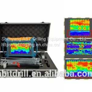
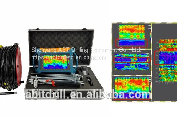
Automatic Mapping Water Detector ANBIT-300S-X


Related Products
ANBIT series automatic mapping pqwt tc300 water detector is based on the Earth’s electromagnetic field as the field source, based on the difference in the conductivity of different underground geological structures, and by studying the variation law of the electric field components at different frequencies to study the geological structure and changes, to find groundwater resources by scientific method.Changes in geological structure are displayed in real-time through multiple curves. Automatic form mapping geological profile by one key operate easily, get rid of complicated computer graphics. The site can quickly understand the geological structure through the automatic mapping curve and profile, and analyze specific information such as aquifers,fractures, faults, and karst caves.The instrument is widely used in the rapid analysis of geological structure changes in different terrains such as plains,hills,mountains, plateaus, and basins to determine well locations, aquifers, and aquifer depth.
The Parts of Automatic Mapping Water pqwt tc300 Detector ANBIT-300S-X
Main switch
Power light
Test light
Systerm reset button
Memory care
USB port
LCD touch screen
Battery holder
Copper electrode
Alloy electrode bar
MN Plug
Electrode cable
The Advantages of Automatic Mapping Water Detector ANBIT-300S-X
1. Apply to multiple and complex terrain exploration
2. The instrument can automatic mapping and get result on site
3. Profile map shows aquifer and depth
4. Expert remote assistance to analysis well location
5. Inexperienced people can learn the operation in 5 minutes
The Wiring Method of Automatic Mapping Water Detector ANBIT-300S-X
(M N are the electrode, O is the measurement point, Point distance is 1-5m)
The data collected by the instrument each time is the midpoint data between the two electrodes. The electrode distance is 10m, and the distance between points is generally 1-5m (the standard is 1m). Electrode spacing and point spacing must keep the same distance for one measuring line. As the left picture shows.
Applications of ANBIT-300S-X Automatic Mapping Water Detector:
ANBIT provides a comprehensive selection of measuring equipments and tools, and a complete set of water well drilling equipments which determining the best drilling position and water depth. KD300 automatic mapping water detector offer a precision detecting service for water well, reduce costs, and handle all kinds of complex terrain.
Specification of Automatic Mapping Water Detector ANBIT-TC300
Model No. |
Depth |
Frequency |
Channel |
System |
Units of measurement |
Measurement Range |
Power Supply |
ANBIT-300S-X |
300 meters |
Single, Triple, 40 |
6 |
PQWT |
△Vs(mV) |
0mV-1500mV |
#26650 4000mAh |
2*Rechargeable lithium battery |
Anbit is one of professional drilling equipment company. We provide Portable Small Air Compressor, Diesel Mobile Air Compressor, drill bit and so on. Want to know more? Please contact us.

Send Inquiry to This Supplier

You May Also Like
-
 Eccentric Overburden Drilling EquipmentUS$ 30 - 2000000MOQ: 1 Piece
 -
HammerUS$ 30 - 2000000MOQ: 1 Piece
-
Hand Hammer DrillUS$ 30 - 2000000MOQ: 1 Piece
-
Hole Opener BitUS$ 30 - 2000000MOQ: 1 Piece
-
ANBIT28 Air Leg DrillUS$ 30 - 2000000MOQ: 1 Bag
-
Alloy Anchor BitUS$ 30 - 2000000MOQ: 1 Bag
-
Anchor BitUS$ 30 - 2000000MOQ: 1 Bag
-
Automatic Mapping Cave DetectorUS$ 30 - 2000000MOQ: 1 Bag
-
Automatic Mapping Cave Detector ANBIT-KD150US$ 30 - 2000000MOQ: 1 Bag
-
Automatic Mapping Cave DetectorNegotiableMOQ: 1 Unit


