

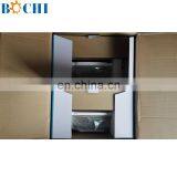
Related Products
-
 New Arrived Ship Chart Plotter MarineUS$ 5.00 - 15.00MOQ: 1 Piece
 -
8 Inch Boat Marine GPS Chart PlotterUS$ 300 - 900MOQ: 1 Piece
-
Best Boat GPS Chart Plotter Marine Use For ShipUS$ 300 - 900MOQ: 1 Piece
-
24V Aluminium 30W/15W Anchor LightUS$ 10 - 100MOQ: 10 Pieces
-
Daylight Signal Communicatunication Signal LightUS$ 10 - 100MOQ: 10 Pieces
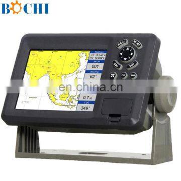
8 Inches GPS Plotter Marine
Features
High resolution TFT day-view LCD display
SD-cards slot for C-Map MAX and user data
C-Map MAX and K-Chart Selectable
Tide table
Versatile display mode include
Plotter Screen
Nav.Data
Satellite Information
AIS Display
Compass Screen
GOTO track navigation
Map orientation select
Proximity waypoints alarms
SPEC:
PLOTTER CHARACTERISTICS | ||
Waypoints/icons | 15,000 waypoints with name, symbol, 10 proximity waypoint | |
Routes | waypoint up to 200 points each, plus MOB and Track Navigation or Goto Track modes | |
Tracks | 30,000 point automatic track log; 15 saved track (up to 2000 track points each) let you retrace your path in both directions | |
Alarms | XTE, Anchor drag, arrival, speed, voltage, proximity waypoint and time, AIS alarm. | |
Pallete | Normal Daylight exposed to sunlight Night in dark environment NOAA paper chart colors | |
Tides | Tide data | |
Projection | Mercator projection | |
Position format | Lat/Lon | |
Basemap | Built-in K-Chart | |
External Map | SD Cards slot for C-Map MAX | |
User data storage | Internal backup of user settings, or external SD-card | |
Plot Interval | 1s to 99h or 0.01 nm to 9.99nm | |
Plotting scales | 0.01nm to 1,000nm | |
Nav Data | Inputs: | |
Perspective View | On/off | |
POWER SUPPLY | 10.5 to 35VDC, current drain <350mA at 12V | |
PHYSICAL | ||
Size | 290mm(H)X195.5mm(W)X99.5mm(D) | |
Weight | 2.43kg | |
Display | 8.0-inches ColorTFT day-view LCD 800 X 600 pixels | |
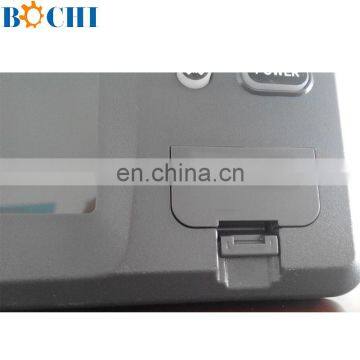
Waterproofing | Display unit: IPX5 | |
Temperature range | Display unit: -15℃ to +55℃ | |
GPS RECEIVER CHARACTERISTICS | ||
Receiver | 50 parallel channel GPS receiver continuously Tracks and uses up to 50 satellites to compute and update your position | |
Acquisition times | Cold start: 27 seconds average | |
Update rate | 1/second,continuous | |
Accuracy | Position: 2.5 meters(95%) without S/A | |
Dynamics | Altitude: 50,000m Max | |
Datum | WGS 84 & Others | |
Interfaces | NMEA 0183 input and output,RS232 and RS422 output | |
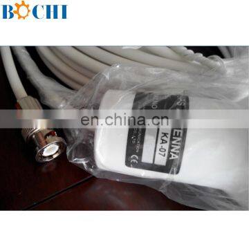
Antenna | KA07 | |
AIS INTERFACE | ||
Data input | NMEA 0183 , RS232 or RS422 | |
Baud rate | 38,400 | |
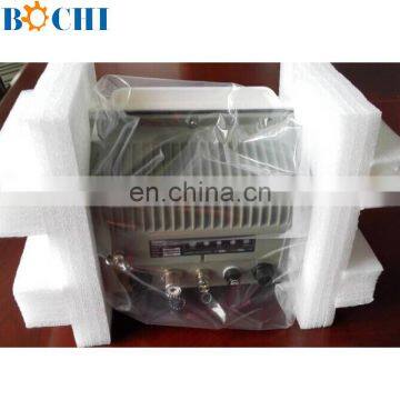
EQUIPMENT LIST | ||
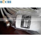
Display unit Antenna unit with 10m cable Operation manual Installation materials and standard spare parts | ||

Send Inquiry to This Supplier

You May Also Like
-
Turbochargers 287-7214, 145-7095 Are Suitable for CAT 3512 and 3516 EnginesNegotiableMOQ: 1 Piece
-
Cab Fixed Rectangular Window for Marine SuppliesCAD 200 - 200MOQ: 1 Piece
-
Hot Sale High Quality Ship Console With Steering WheelNegotiableMOQ: 1
-
BOCHI Customized Small Boat Front WindscreenUS$ 300 - 380MOQ: 5 Sets
-
Gorgeous Marine Steel Hatch Cover Supplier With Rich ExperienceUS$ 5 - 20.9MOQ: 500 Pieces
-
Rotomolding Pontoon FactoryUS$ 1 - 100MOQ: 500 Kilograms
-
Volvo Penta Marine Engine 12V Electrical Oil Bilge Pump 843114 842855 for D1-13 D2-55F D2-60F D2-75US$ 50 - 250MOQ: 1 Piece
-
SHIP FUEL NOZZLE BOAT NOZZLE MARINE NOZZLE ZCK150S832 DL150T388 DL150T308 DL150T288US$ 17.5 - 25MOQ: 12 Pieces
-
Rope Ratchet Heavy Duty Yoyo HangerUS$ 0.5 - 2MOQ: 100 Pieces
-
Eva Foam Boat HullUS$ 100 - 100MOQ: 50 Pieces

