

Home > Electrical & Electronics > GPS > GPS Navigator > Garmin GPSMAP 60CSx Expandable Color Hand Held GPS Receiver
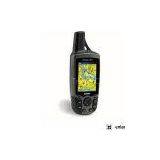
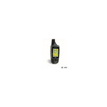
Garmin GPSMAP 60CSx Expandable Color Hand Held GPS Receiver
Negotiable
MOQ: 33 Pieces (Price negotiable depending on order volume and customization)
Key Specifications
Get Latest Price
Brand Name:
Garmin
Place of Origin:
China
Model Number:
Payment & Shipping
Payment Methods:
Port of Shipment:
China
Delivery Detail:
7 days
Related Products
-
 Garmin GPS 72H Hand Held GPS ReceiverNegotiableMOQ: 33 Pieces
 -
Bushnell ONIX 350 Portable Color Handheld GPS Unit Satellite ImageNegotiableMOQ: 33 Pieces
-
Garmin GPSMAP 62SC Rugged Handheld GPS Receiver w/ Digital CameraNegotiableMOQ: 33 Pieces
-
Furuno Mfd12 Display Navnet 3DNegotiableMOQ: 20 Pieces
-
Garmin 62st GpsmapNegotiableMOQ: 20 Pieces
Brand Name
Garmin
Place of Origin
China
The Garmin GPSMAP 60CSx has all the features of the GPSMAP 60CS, with two important differences. It uses a new SiRFstarIII high-sensitivity GPS receiver, which gives you GPS coverage even under dense foliage and in deep canyons. The GPSMAP 60CSx also does away with internal memory. It comes with a 64MB microSD flash memory card, so you can use multiple cards for navigation, or order a larger card to fit a bigger map segment in your unit. You can use the included USB cable to load your maps from your PC.
GPSMAP 60CSx Features:
- New high-sensitivity WAAS-capable GPS receiver by SiRF
- Built-in quad-helix receiving antenna with remote antenna capability
- Unit dimensions: 2.4" W x 6.1" H x 1.3" D
- Display: 1.5" W x 2.2" H, 2.6"-diagonal, 256-color, transflective TFT (160 x 240 pixels)
- Weight: 7.5 ounces with batteries (not included)
-
Sensors:
- Electronic compass displays accurate heading while standing still
-
Barometric altimeter with automatic pressure trend recording
- microSD card slot allows for storage of optional MapSource detail (64 MB microSD included)
- LED backlit display and keypad
- Battery life: 20 hours (typical use) using two AA alkaline batteries
- Includes a built-in Americas autoroute basemap with automatic routing capabilities, including highways, exits, and tide data (USA only)
- Internal memory is preloaded with a marine point database
- 1,000 user waypoints with name and graphic symbol; 50 reversible routes
- Position formats include Lat/Lon, UTM, Loran TDs, Maidenhead, MGRS, user grid, and more
- Audible alarms for anchor drag, arrival, off-course, proximity waypoint, and clock
- Large-numbers option for easy viewing; dual-position display mode
- Trip computer provides odometer, stopped time, moving average, overall average, total time, max speed, and more
- 10,000-point automatic track log; 20 saved tracks (500 points each) let you retrace your path in both directions
- Elevation computer provides current elevation, ascent/descent rate, minimum/ maximum elevation, total ascent and descent, average and maximum ascent and descent rate
- Navigation instructions can be shared with repeaters, plotters, and autopilots using NMEA protocols through the dedicated serial port.
- Built-in celestial tables for sun and moon calculations and the best times to fish and hunt
- Compatible with most MapSource products including BlueChart, City Navigator, U.S. TOPO 24K, U.S. TOPO, and Recreational Lakes with Fishing Hot Spots
- Water resistant: IEC 60529 IPX7 standards
Looking for an expired rebate form? Click here to download it.
Package Includes
Package Includes:
- GPSMAP 60CSx unit
- 64 MB microSD card
- Belt clip
- USB interface cable
- MapSource Trip & Waypoint Manager CD
- Lanyard
- Owner's Manual
- Quick-Start Guide

Send Inquiry to This Supplier

* Email
Want the best price?
Post an RFQ now!
Business Type
Trading Company
Year Established
1993
Total Employees
101 - 200 People
Main Markets
North America, South America, Eastern Europe
You May Also Like
-
Original SMC IP200-120 Cylinder Positioner New Original AuthenticNegotiableMOQ: 1 Piece
-
12 Inches LCD Display Marine GPS AIS ReceiverUS$ 300 - 900MOQ: 1 Set
-
Alarm Monitoring Center Software for Navigation & GPSUS$ 5 - 55MOQ: 1 Piece
-
Gps Digital Tracking Fuel Level SensorUS$ 40 - 70MOQ: 1 Piece
-
RION-BD982 High Positioning Accuracy GPS Navigation,Can Provide Position Information of Carrier (longitude, Latitude, Height)...NegotiableMOQ: 1 Set
-
GPS+GSM (850/900/1800/1900/2100MHz) / 3dBi GSM, 28dBi GPS Gain GSM/GPS AntennaUS$ 3.5 - 4.5MOQ: 10 Pieces
-
Speed Governor 3098693US$ 1 - 90MOQ: 1 Piece
-
Gps Tracker Key Chain Gps TrackerUS$ 1 - 3MOQ: 500 Pieces
-
The Supply of Digital Printing Clothing ProcessingmNegotiableMOQ: 1 Piece
-
Benz C4 2011 STAR Scanner Mercedes Benz Star Diagnostic Tool MB SD Connect Compact4NegotiableMOQ: 1 Piece

