

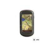
Garmin Oregon 550t Touch-Screen Handheld GPS Receiver
Related Products
-
 Garmin Oregon 450t Touch-Screen Handheld GPS ReceiverNegotiableMOQ: 33 Pieces
 -
Garmin GPSMAP 78sc Color Hand Held GPS ReceiverNegotiableMOQ: 33 Pieces
-
Garmin GPSMAP 62ST Rugged High Performance Handheld GPS ReceiverNegotiableMOQ: 33 Pieces
-
Magellan EXplorist 710 Hand Held GPS ReceiverNegotiableMOQ: 33 Pieces
-
Garmin ETrex Vista HCx Expandable Color Hand Held GPS ReceiverNegotiableMOQ: 33 Pieces
The navigator with the photographic memory — Garmin Oregon 550t combines rugged outdoor touchscreen navigation and pre-loaded 3D topo maps with a 3.2 megapixel digital camera. The result? A multipurpose device that will make your biggest adventures even more memorable. Also new is the addition of the 3-axis tilt-compensated compass. This will allow the unit to report an accurate heading even when the unit is not held in a level position.
Take Pictures and Save Locations
Capture locations and memories with Oregon 550t's 3.2 megapixel autofocus digital camera with 4x digital zoom. Each photo is automatically geotagged with the location of where it was taken, allowing you to navigate back to that exact spot in the future. Snap and view pictures in landscape or portrait orientation. With 850 MB of internal memory, you'll never miss a photo opportunity. To store online, simply connect Oregon 550t via USB and log into to upload and store your photos at Picasa, a popular online photo sharing community for friends and families around the world. For more storage, insert a microSD card; you can even view pictures from other devices on microSD with Oregon's picture viewer.
Touch and Go
Oregon 550t makes rugged navigation effortless with a tough, 3-inch diagonal, sunlight-readable, color touchscreen display. The interface is easy to use, so you’ll spend more time enjoying the outdoors and less time searching for information. Both durable and waterproof, Oregon 550t is built to withstand the elements. Bumps, dust, dirt, humidity and water are no match for this rugged navigator.
Explore the Terrain
Oregon 550t comes with built-in U.S. topographic data for the continental U.S. and a worldwide basemap with shaded relief — all the tools for serious climbing or hiking. Map detail includes national, state and local parks and forests, along with terrain contours, elevation information, trails, rivers, lakes and points of interest.
Get Your Bearings
Oregon 550t has a built-in 3-axis tilt-compensated electronic compass, which shows your heading even when you’re standing still, without holding it level. Its barometric altimeter tracks changes in pressure to pinpoint your precise altitude, and you can even use it to plot barometric pressure over time, which can help you keep an eye on changing weather conditions. And with its high-sensitivity, WAAS-enabled GPS receiver and HotFix satellite prediction, Oregon 550t locates your position quickly and precisely and maintains its GPS location even in heavy cover and deep canyons.
Add Maps
Conveniently plug in optional preloaded microSD cards for all your outdoor activities on land or water (click here for help selecting a map). Just insert a MapSource card with detailed street maps, and Oregon provides turn-by-turn directions to your destination. Add detailed trail information by purchasing additional TOPO maps for national parks and more. With BlueChart g2, you'll get everything you need for a great day on the water including depth contours, navaids and harbors. The card slot is located inside the waterproof battery compartment, so you don't have to worry about getting it wet.
Find Fun
Go paperless with Oregon 550t by quickly downloading information from for up to 5000 caches, such as location, terrain, difficulty, hints and description. No more manually entering coordinates and paper print outs. Slim and lightweight, Oregon is the perfect companion for all your outdoor pursuits.
Share Wirelessly
With Oregon 550t you can share your waypoints, tracks, routes and geocaches wirelessly other Oregon and Colorado users. Now you can send your favorite route to a friend to enjoy or the location of a cache to find. Sharing data is easy. Just touch "send" to transfer your information to similar devices.
If you’re looking for the perfect multipurpose tool for your outdoor adventure, all you need is a rugged Oregon 550 or 550t GPS navigator. They offer everything you need for a memorable time in the outdoors or wherever the trail may take you!
Garmin Oregon Comparison Chart
| Oregon 300 | Oregon 400t | Oregon 450 | Oregon 450t | Oregon 550 | Oregon 550t | |
| Compass, barometric altimeter | Yes | Yes | Yes, enhanced 3-axis | Yes, enhanced 3-axis | Yes, enhanced 3-axis | Yes, enhanced 3-axis |
| Alarm and Beeper | Yes | Yes | Yes | Yes | Yes | Yes |
| Wireless exchange | Yes | Yes | Yes | Yes | Yes | Yes |
| Coverage | Worldwide DEM basemap | U.S. Topo | Worldwide DEM basemap | U.S. Topo | Worldwide DEM basemap | U.S. Topo |
| Batteries Included | no | no | no | no | Yes, rechargeable | Yes, rechargeable |
| Digital Camera | no | no | no | no | Yes | Yes |
| Waypoints/favorites/locations | 1000 | 1000 | 2000 | 2000 | 2000 | 2000 |
| Routes | 50 | 50 | 200 | 200 | 200 | 200 |
| Track log | 10,000 points, 20 saved tracks | 10,000 points, 20 saved tracks | 10,000 points, 200 saved tracks | 10,000 points, 200 saved tracks | 10,000 points, 200 saved tracks | 10,000 points, 200 saved tracks |
| Pricing | $379.99 | $399.99 | 399.99 | 499.99 | $499.99 | $599.99 |
Oregon 550t: Picture the great outdoors.

Send Inquiry to This Supplier

You May Also Like
-
Original SMC IP200-120 Cylinder Positioner New Original AuthenticNegotiableMOQ: 1 Piece
-
12 Inches LCD Display Marine GPS AIS ReceiverUS$ 300 - 900MOQ: 1 Set
-
Alarm Monitoring Center Software for Navigation & GPSUS$ 5 - 55MOQ: 1 Piece
-
Gps Digital Tracking Fuel Level SensorUS$ 40 - 70MOQ: 1 Piece
-
RION-BD982 High Positioning Accuracy GPS Navigation,Can Provide Position Information of Carrier (longitude, Latitude, Height)...NegotiableMOQ: 1 Set
-
GPS+GSM (850/900/1800/1900/2100MHz) / 3dBi GSM, 28dBi GPS Gain GSM/GPS AntennaUS$ 3.5 - 4.5MOQ: 10 Pieces
-
Speed Governor 3098693US$ 1 - 90MOQ: 1 Piece
-
Gps Tracker Key Chain Gps TrackerUS$ 1 - 3MOQ: 500 Pieces
-
The Supply of Digital Printing Clothing ProcessingmNegotiableMOQ: 1 Piece
-
Benz C4 2011 STAR Scanner Mercedes Benz Star Diagnostic Tool MB SD Connect Compact4NegotiableMOQ: 1 Piece

