

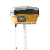
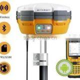
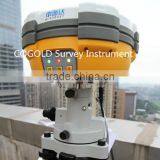
Brand New Hi-taregt GPS RTK Land Surveying Instruments for Sale


Related Products
-
 LED Display Screen GPS GNSS Survey InstrumentUS$ 0.1 - 0.2MOQ: 1 Set
 -
Buliding and Construction Surveying Equipment Total Station or Laser TheodoliteUS$ 0.1 - 0.2MOQ: 1 Set
-
Hi-target HTS 220R Total Station Surveying InstrumentUS$ 0.1 - 0.2MOQ: 1 Set
-
Topographic Survey Instruments GPS Surveying Total StationsUS$ 0.1 - 0.2MOQ: 1 Set
-
Optiacl Total Station Laser Total Station Reflectorless Total Station Survey EquipmentsUS$ 0.1 - 0.2MOQ: 1 Set
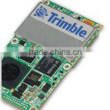
Established in 1999, Hi-Target Survey Instruments Company Ltd engaging in GNSS high-tech technology industry, covering from GNSS technology development, to production as well as marketing and sales. In China, Hi-Target has established a nationwide sales and service network with 30 branches, 7 technical service centers.
Hi-Target has 4 core businesses involved in surveying GNSS product series, digital sounder series, GIS data acquisition system, marine engineering application integrated system, marine surveying, and marine mapping software products.
Hi-Target have more than 1000 employees, they are long-term commit GNSS technology research and development, production, marketing services and involved in the development of the whole process of localization of GNSS.
Technical parameters:
MEASUREMENTS
Satellite signals tracked simultaneously
Application:
1. Contour / Site Surveys
2.Construction and/or Roads Surveys
3.Industrial Surveys
4.Geographical Information Systems (GIS)
5.Photogrammetric Surveys
6.Precision Surveys
7.Hydrographic Surveys
8.Mining Surveys
Our warranty policy:
1. For instruments (total station,GNSS), we offer 1 year warranty,for accesories(Prism,pole,tripod,).we offer 6 months warranty,from the day you get the product.
2. For hardware problem.Please send us the photos,and we will send the damaged part to you for free.For big issues like main board etc,please send them to us and we will repair them in 10 work days.We should take care the freight on each side.
3.For software problem. We will arrange for the video conference with the engineer (GMT+8 9:00-18:00)Or you can connect the with the engineer directly.
4. We also can arrange our engineer to solve the Customer's problems to customer's working place but the cost will be undertaken by customers. And we are also welcome that the customer come to our company to learn how to operate the instrument and how to maintain the instrument.
Thank you for your time, We are looking forward to your enquiry to:
Email: GOLD17(@).
Skype: Ceilin.Wang2015
Mobile:0086-15922922485
Viber/ WhatsApp: +86-13617601606
Or fill in with below form, Thanks.

Send Inquiry to This Supplier

You May Also Like
-
Original SMC IP200-120 Cylinder Positioner New Original AuthenticNegotiableMOQ: 1 Piece
-
GPS NavigatorNegotiableMOQ: 2500 Pieces
-
Alarm Monitoring Center Software for Navigation & GPSUS$ 5 - 55MOQ: 1 Piece
-
Analog Capacitive Level Sensor With Stainless Steel ProbeUS$ 40 - 80MOQ: 1 Piece
-
RION-BD982 High Positioning Accuracy GPS Navigation,Can Provide Position Information of Carrier (longitude, Latitude, Height)...NegotiableMOQ: 1 Set
-
GPS+GSM (850/900/1800/1900/2100MHz) / 3dBi GSM, 28dBi GPS Gain GSM/GPS AntennaUS$ 3.5 - 4.5MOQ: 10 Pieces
-
Speed Governor 3098693US$ 1 - 90MOQ: 1 Piece
-
Gps Tracker Key Chain Gps TrackerUS$ 1 - 3MOQ: 500 Pieces
-
Child Aviation Restraint System for Airplane TravelEUR 3 - 7MOQ: 200 Pieces
-
Globalsat BU-353 BU353 Android Tablet USB GPS Receiver Linux SIRF III Navigation Micro USB GPS Receiver BlackUS$ 1 - 100MOQ: 100 Pieces

