








 Contact Platform Support
 Help Center
Home > Electrical & Electronics > GPS > GPS Navigator > Centimeter Level High Accuracy GIS Data Collector for Surveying and Construction
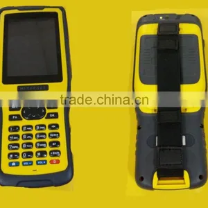
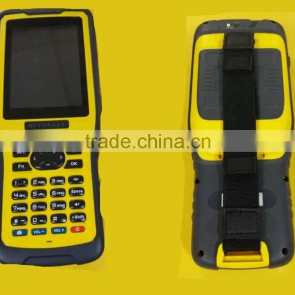
Centimeter Level High Accuracy GIS Data Collector for Surveying and Construction
US$ 0.1 - 0.2
MOQ: 1 Set
Key Specifications
Get Latest Price
Type:
Gps Navigator
Use:
Hand Held
Screen Size:
3.5 inch
Payment & Shipping
Payment Methods:


Port of Shipment:
Shanghai
Delivery Detail:
Delivery time depends on order quantity.
Related Products
-
 New Coming Handheld Rtk GPS Rover GIS Data Collector for Surveying and ConstructionUS$ 0.1 - 0.2MOQ: 1 Set
 -
Series of Hi-Target Qstar GPS GIS CollectorUS$ 0.1 - 0.2MOQ: 1 Set
-
Land Survey and Manage GIS Collector GPSUS$ 0.1 - 0.2MOQ: 1 Set
-
HI-TARGET Qstar8 Dual Frequency Handheld GPS ControllerUS$ 0.1 - 0.2MOQ: 1 Set
-
Portable Handheld Rtk GPS GNSS Data Collector GPS Surveying EquipmentUS$ 0.1 - 0.2MOQ: 1 Set
Type
Gps Navigator
Use
Hand Held
Screen Size
3.5 inch
Function
Bluetooth-enabled, Mp3/Mp4, Photo Viewer, Radio Tuner, Touch Screen
Place of Origin
Chongqing, China
Brand Name
Hi-target
Model Number
Qstar8
Warranty
12 Months
Centimeter Level High Accuracy GIS Data Collector for Surveying and Construction
Product Description
Qstar8 brings the essential functionality for high accuracy GIS data collection in one device. It is also the most cost-effective high accuracy network RTK rover.
Shining Points
Faster
Microsoft Windows Mobile 6.5
806MHZ high-speed CPU
256M RAM, 8G flash memory
Higher accuracy
GPS+GLONASS+COMPASS
Advanced PPP technology
Solider
1.5M anti-drop, IP67
Integrated elaborate double color model
Main features
- 5 million pixel auto focus camera
Accurate centering mode
Integrated high accuracy G-sensor, Centering GNSS antenna phase center accurately
Electronically level GNSS antenna
- Multiple wireless communication modes
Integrated 3G communication function, Supports all 3G communication systems
Integrated Bluetooth, WIFI, USB communication , Makes wirelessly assist telemeter &detecting instrument etc. to work synchronously.
- GNSS positioning technology
With reliable GPS+GNSS positioning technology, you can work normally even under hard environmental conditions.
Support COMPASS satellite navigation system.
Advanced PPP technology realizehigher accuracy even just adopt single point positioning.
- 3.7 inch QVGA TFT, resolution: 640×480
8800mAh Li-ion battery, over 12 hours’ continuous work

Send Inquiry to This Supplier

Business Type
Trading Company
Year Established
2015
Factory Size
Below 1,000 square meters
Total Employees
51 - 100 People
You May Also Like
-
Original SMC IP200-120 Cylinder Positioner New Original AuthenticNegotiableMOQ: 1 Piece
-
GPS NavigatorNegotiableMOQ: 2500 Pieces
-
Alarm Monitoring Center Software for Navigation & GPSUS$ 5 - 55MOQ: 1 Piece
-
Analog Capacitive Level Sensor With Stainless Steel ProbeUS$ 40 - 80MOQ: 1 Piece
-
RION-BD982 High Positioning Accuracy GPS Navigation,Can Provide Position Information of Carrier (longitude, Latitude, Height)...NegotiableMOQ: 1 Set
-
GPS+GSM (850/900/1800/1900/2100MHz) / 3dBi GSM, 28dBi GPS Gain GSM/GPS AntennaUS$ 3.5 - 4.5MOQ: 10 Pieces
-
Speed Governor 3098693US$ 1 - 90MOQ: 1 Piece
-
Gps Tracker Key Chain Gps TrackerUS$ 1 - 3MOQ: 500 Pieces
-
Child Aviation Restraint System for Airplane TravelEUR 3 - 7MOQ: 200 Pieces
-
Globalsat BU-353 BU353 Android Tablet USB GPS Receiver Linux SIRF III Navigation Micro USB GPS Receiver BlackUS$ 1 - 100MOQ: 100 Pieces

